


Drone Survey to Update Coimbatore’s Land Records Begins this Month-End
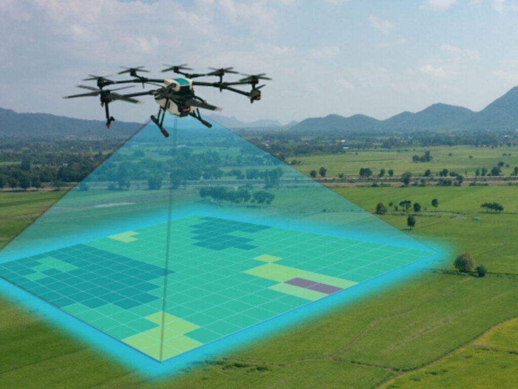
In a move that could bring a modernized land survey using drone technology to the city, all the procedures are nearing completion under the Union government’s Digital India Land Records Modernization Programme (DILRMP). The NAKSHA, or the National Geospatial Knowledge-based Land Survey of Urban Habitations, has already kick-started the preliminary work in seven wards of the city with a plan to make an accurate and comprehensive database of the records on land.
In this pilot project, drones will survey an area of 10.44 sq. km with 73,263 buildings, on a 1 × 1 km grid. With Coimbatore’s persistent urban growth, officials from the Survey and Land Records Department highlighted the importance of this initiative.
More Accuracy with High-Tech Survey
“The work of the drone survey will start by the end of this month and will be completed in three days,” a senior official explained. The collected data will be used in generating ortho-rectified images (ORI) of the land with very high accuracy. Subsequently, a team from the Revenue and Municipal Administration Departments will conduct a ground-truthing process of verifying the land records with real-world observations and updating them accordingly.
This will make use of high-end instrumentations such as the Electronic Total Station (ETS) and Differential Global Positioning System (DGPS) for accurate measurements. The full survey process will take six months, then the draft field map will be prepared and available for public review.
Public Outreach and Integration with Property Tax
Landowners would then be able to review the new records and file any objections, which will be resolved by official procedures. After they are approved, the urban land records would be linked to the property tax records, creating a linkage between ownership and tax.
This project will be delivered in an estimated period of 1 year and aims to provide a full land governance solution that will include transparency and efficiency. In addition, the drone survey will also collect data on trees that can be used in urban planning and environmental assessments.
This priority initiative will greatly enhance the land records at the urban level and improve land governance through an advanced Geographic Information System (GIS) based land management system.


Related Articles

TVS ILP Expands Into East India With New Logistics Park Project In Siliguri
TVS Industrial & Logistics Parks has entered the East Indian market with...
Cement makers expect demand recovery ahead of monsoon despite rising input costs
India’s cement industry is expecting a demand revival in May ahead of...

Steel Ministry Reviews BIS Certification Norms for Fastener Industry Amid MSME Concerns
The Ministry of Steel has initiated consultations on easing BIS certification norms...
HYDRAA Demolishes Illegal Stone Crushing and RMC Units Near Hyderabad
HYDRAA demolished eight stone crushing units and three ready mix concrete plants...
Leave a comment